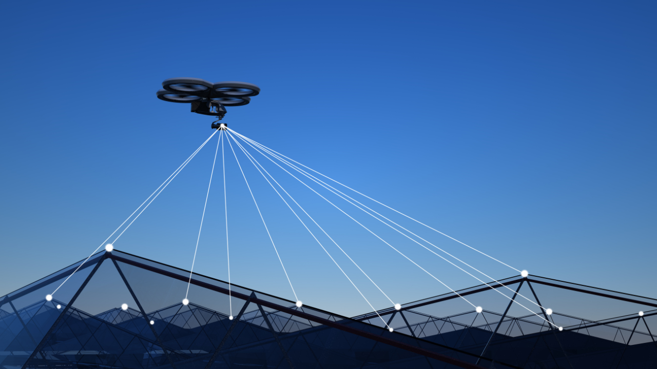
The use of the best drone for mapping is becoming increasingly popular. Drones provide a cost-effective, accurate, and quick way to capture data and images of the earth’s surface. They can map various locations, from large industrial sites to agricultural fields. Drone mapping technology provides an efficient way to monitor land changes and urban plan development.
If you are looking for the best drone for mapping, you’re in luck! In this review, we’ll look at the 5 best drones for mapping to help you decide on the best drone for your needs. We’ll discuss each drone’s features, advantages, disadvantages, and tips for making the most of your drone mapping experience. Read on to learn more about drones for mapping!
Drones come in various sizes and capabilities. Smaller drones are often used for photography, while larger drones are typically used for mapping. Multirotor and fixed-wing aircraft are the two most common types of drones used for mapping. Multirotor drones offer the advantage of hovering in one place, while fixed-wing drones allow for greater distances and higher speeds.
For better understanding we have compiled a list of top rated and best drone for mapping available in the market. Lets dive in!
Also Read: 5 Best Drones Under 300 (2023 Edition)
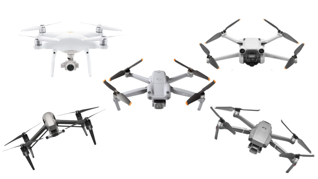
Best Drone For Mapping: Recommendations
| Design | Model | Retailer |
|---|---|---|
 |
DJI Phantom 4 Pro Plus V2.0 | Check Price |
 |
DJI Mavic 2 Pro | Check Price |
 |
DJI Inspire 2 | Check Price |
 |
DJI Air 2S | Check Price |
 |
DJI Mini 3 Pro | Check Price |
Specifications
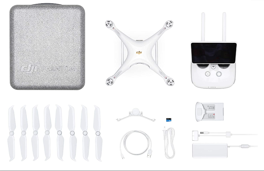
DJI Phantom 4 Pro Plus V2.0 – Powerful and best drone for mapping
| Brand | DJI |
| Model | Phantom 4 Pro Plus V2.0 |
| Video Resolution | 2K DCI 1080p |
| Image Resolution | 20 MP |
| Maximum Flight Speed | 72 kph |
| Transmission Range | 8 km |
The DJI Phantom 4 Pro Plus V2.0 is the best drone for mapping in the market today. This powerhouse drone has much to offer, including a 1-inch CMOS sensor, 20 MP camera, and 2K DCI 1080p video recording capabilities. Its powerful flight motors and upgraded flight controller make it a great choice for any mapping project.
Additionally, it offers obstacle avoidance technology, allowing for smooth and safe flights. The Phantom 4 Pro Plus V2.0 has an array of sensors and features, such as an integrated GPS, altitude hold, ultrasonic rangefinder, and vision positioning system.
These features make it easy to use and ideal for mapping projects. The advanced battery system ensures extended flights, while the intuitive control system simplifies drone flying. The live HD view feature allows you to monitor your progress in real-time from up to 7 kilometers away.
Thanks to its foldable design, the Phantom 4 Pro Plus V2.0 can easily fit into backpacks or bags for convenient portability. Furthermore, this best drone for mapping can be used indoors and outdoors, making it versatile for all projects.
With all these features and more, it’s no wonder this best drone for mapping is highly regarded among professionals and hobbyists.
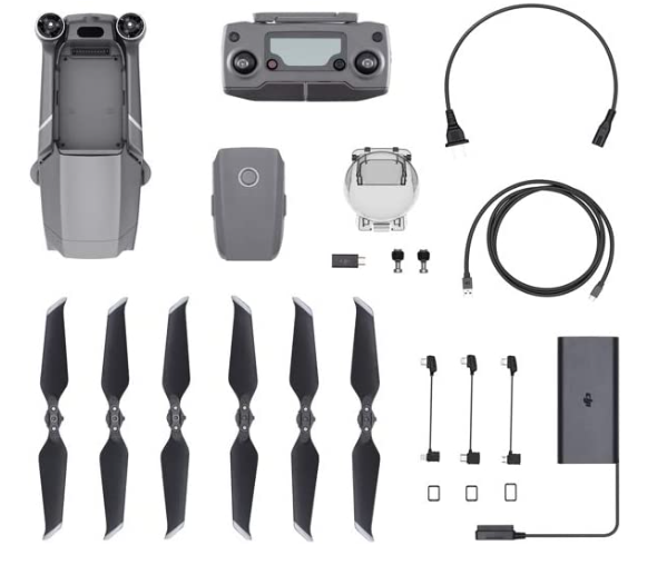
DJI Mavic 2 Pro – Best for smaller areas with greater accuracy
| Brand | DJI |
| Model | Mavic 2 Pro |
| Video Resolution | 4K HD |
| Image Resolution | 20 MP |
| Maximum Flight Speed | 70.81 kph |
| Flight Time | 31 minutes |
The DJI Mavic 2 Pro is one of the most popular and the best drone for mapping in the market. It features a 1″ Hasselblad L1D-20c camera with a maximum resolution of 20 megapixels, an adjustable aperture of f/2.8 – f/11, and a mechanical shutter with a speed of up to 1/8000s.
Its 4K video recording capabilities are great for capturing detailed footage for mapping and surveying applications. The Mavic 2 Pro also has a maximum speed of 44 mph (72 km/h) and a maximum flight time of 31 minutes, allowing you to cover larger areas in less time.
In addition, the Mavic 2 Pro includes obstacle avoidance technology for safer flight, a hyper-lapse function for time-lapse photography, and autonomous flight modes like ActiveTrack 2.0 and Point of Interest. Its new OcuSync 2.0 system ensures clear and reliable data transmission up to 8km away.
Overall, the DJI Mavic 2 Pro is a great choice for professionals and hobbyists looking for an easy-to-use drone that can provide high-quality results and the best drone for mapping and surveying. Its powerful features and affordable price make it one of the best options on the market today.
DJI Inspire 2 – Best for large-scale mapping
| Brand | DJI |
| Model | Inspire 2 |
| Video Resolution | 6K, 5.2K |
| Image Resolution | 24 MP |
| Maximum Flight Speed | 94 kph |
| Flight Time | 27 minutes |
The DJI Inspire 2 is a powerful and versatile drone with impressive features that make it the best drone for mapping. It is the perfect drone for aerial photography and cinematography, as it can shoot 6K videos at up to 30 fps and capture 20MP photos in RAW format.
It has many sensors, including obstacle avoidance and vision positioning systems, to help you get the needed shots. The Inspire 2 also comes with various automated flight modes, such as Point of Interest and Follow Me, making it easy to capture dynamic shots.
With its remarkable battery life of up to 27 minutes, this drone can fly long distances and capture long exposures. It is also compatible with the DJI Zenmuse X4S camera, which has an adjustable aperture from f2.8 to f11, allowing for high-quality images and videos.
Furthermore, being the best drone for mapping, it supports intelligent functions such as Intelligent Flight Modes, Focus Track, and ActiveTrack, allowing you to easily capture amazing footage.
DJI Air 2S – Best for HD images and videos
| Brand | DJI |
| Model | Air 2S |
| Video Resolution | 5.4K HD |
| Image Resolution | 20 MP |
| Maximum Flight Time | 31 minutes |
| Transmission Range | 12 km |
The DJI Air 2S is among the best drone for mapping and surveying, thanks to its advanced imaging capabilities. It features an advanced 20MP 1″ CMOS sensor, capable of capturing sharp 4K/60fps, 5.2K/30fps video and 48MP stills.
Its large sensor size gives you better low-light performance and improved photo clarity and detail. In addition, its dual-focus system ensures that you get pin-sharp focus and a wide dynamic range when shooting. With support for ActiveTrack 3.0, the Air 2S is great for precisely tracking fast-moving objects.
The drone has various intelligent flight modes, including QuickShots, Hyperlapse, and Point of Interest. QuickShots lets you capture stunning cinematic footage with a button, while Hyperlapse lets you record smooth and stable motion time-lapses. With the Point of Interest feature, you can automatically tell the Air 2S to circle around an object, so you can focus on capturing the perfect shot.
With its powerful specs and features, the DJI Air 2S is a great choice for professionals looking for the best drone for mapping and surveying. The DJI Air 2S offers up to 31 minutes of flight time and has a maximum range of up to 12 kilometers. It also includes obstacle avoidance sensors, which will help it avoid crashing into any obstacles while in flight.
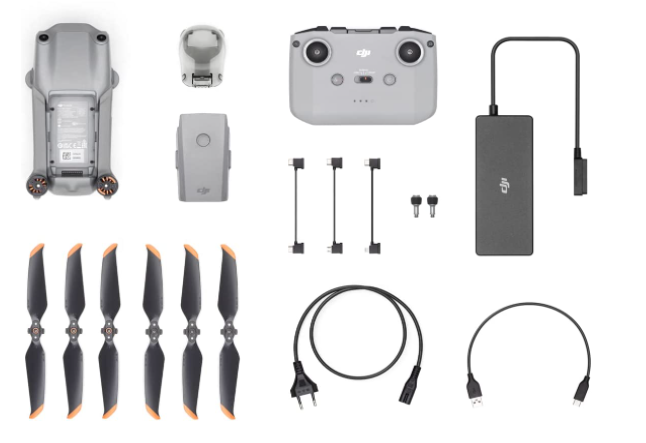
DJI Mini 3 Pro – best for beginners in mapping
| Brand | DJI |
| Model | Mini 3 Pro |
| Video Resolution | 4K HDR |
| Image Resolution | 48MP |
| Maximum Flight Time | Optional 34/47-min |
| Transmission Range | 12 km |
The DJI Mini 3 Pro is one of the best drones for mapping, providing aerial photography and videography capabilities that are perfect for mapping projects. The Mini 3 Pro is an ultra-lightweight drone with a camera mounted on its underside, allowing it to capture stunning 4K video at 30 frames per second and 12-megapixel photos.
Its integrated 3-axis gimbal allows for smooth and stable footage, even in windy conditions. This drone has a maximum speed of 36 mph, a maximum flight time of 47 minutes, and a maximum control range of 12km.
The Mini 3 Pro also has several intelligent flight modes, such as Waypoints and Follow Me, which make it the best drone for mapping by easily mapping out large areas quickly and accurately. In addition, the Mini 3 Pro comes with a remote controller and uses GPS navigation for precise flight control and positioning.
Best drone for mapping: Which is best for you?
When choosing the best drone for mapping, it is important to consider your specific needs. Different drones have different features and capabilities, so it is important to consider your budget, desired flight time, type of sensors needed, and other factors before selecting a drone for your project. Understanding the local regulations when flying a drone for mapping is also important.
In the end when choosing the best drone for mapping, the decision will ultimately come down to the intended use and budget. If you’re looking for a versatile, high-quality drone with advanced capabilities, then the DJI Phantom 4 Pro Plus V2.0 is a great choice.
On the other hand, the DJI Mavic 2 Pro provides an excellent balance of features and price points that could make it ideal for many users. The DJI Inspire 2 Drone offers a more powerful motor and flight control system, while the DJI Air 2S boasts superior imaging capabilities.
Finally, the DJI Mini 3 Pro is perfect for those who need an affordable but capable drone for basic mapping tasks. Ultimately, when it comes to the best drone for mapping, there is no “one-size-fits-all” answer – only you can decide which model best suits your needs and budget.
Conclusion
When choosing the best drone for mapping, the decision comes down to what you need and how much you are willing to spend. All of the drones mentioned above are excellent choices for mapping, and each one offers something different in terms of features and capabilities.
The DJI Phantom 4 Pro Plus V2.0 is great for aerial mapping because of its powerful camera, while the DJI Mavic 2 Pro is perfect for mapping smaller areas with greater accuracy.
The DJI Inspire 2 Drone provides excellent image quality for large-scale mapping projects, and the DJI Air 2S is perfect for capturing high-resolution images and videos. Finally, the DJI Mini 3 Pro is great for budget-conscious users who want to get started in drone mapping.
No matter which drone you choose, you will find that it meets your needs and helps you achieve your goals.